


Choquequirao: A Hike Between Heights and Greenery
First times are never forgotten. They inspire us forever and remain in our memories. Our lives are marked by those groundbreaking and revealing experiences. Some are not very pleasant, like the inconsolable crying at the start of school, the unexpected defeat in the final of a sports championship, or the discovery of pain from the loss of a loved one.
Life is a whirlwind of contradictory sensations and emotions. This also happens with first times, because while many are remembered with sadness, there are also many whose recollection brings immense joy. Yes, people often talk about love or that shy first kiss, but today I’m going to write about another first time, one that perhaps you haven’t experienced yet.
I hope that after reading this, you’ll be encouraged to take that first step, literally your first step on an Andean and Amazonian trail that descends into the depths of a canyon and then climbs steep slopes in search of a stone city. This is the experience I want to share with you so that your debut journey in Peru is on a fascinating, challenging, and contradictory route, much like life itself.
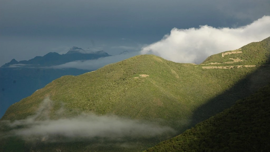
Apologies if I got carried away by my excitement. I hope you understand that my first trek to an archaeological site “planted” in the greenery of a mountain was along the winding, long, and exhausting trail that leads to Choquequirao, the stone city that, according to some accounts, was the refuge of the rebellious Cusqueños led by the legendary Manco Inca.
I first went there over 20 years ago. Back then, few people knew the route, and even fewer ventured on this four-day foot journey. Access to the archaeological site was free, and you could even camp in the Inca plaza. Today, it’s not the same. Many things have changed, but the emotions this adventure evokes remain intact. Come along with me!
Cachora: The Starting Point
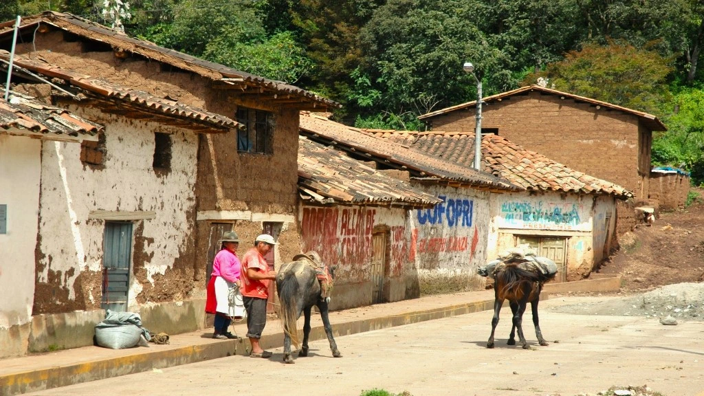
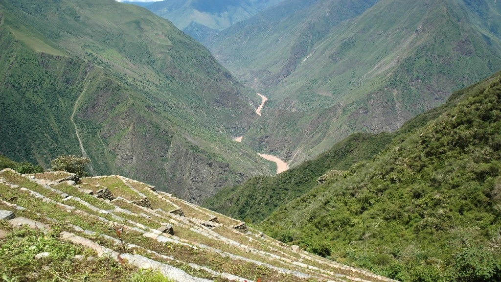
Nervousness. That’s what I felt when the time came to take the first step. Would I make it? A little voice kept hammering in my mind. I didn’t know. I had never walked around 60 kilometers, neither on the coast nor on flatlands. Yes, a lot of nerves. That’s what I felt on the outskirts of the village of Cachora, when a muleteer showed me that my destination lay high up on a mountain on the other side of the Apurímac River canyon.
It seemed impossible. My legs wouldn’t be able to handle the challenge of going down and climbing the mountains that framed the waters of the “God Who Speaks” (that’s the river’s name in Spanish). But giving up wasn’t an option. I wanted my first time to be a success, even though reason and my limited trekking experience made me think otherwise. “Come on, you can do it,” I encouraged myself, more full of doubt than certainty.
Now, as I think back to that crucial moment, now that I see myself once again in the streets of Cachora (in the province of Abancay, Apurímac region), now that I remember my hesitant steps behind the mules carrying tents and gas canisters, I am once again convinced that I did the right thing by not giving up, by convincing myself that there’s always one more step to take, and by realizing that the journey is meant to be completed from beginning to end.
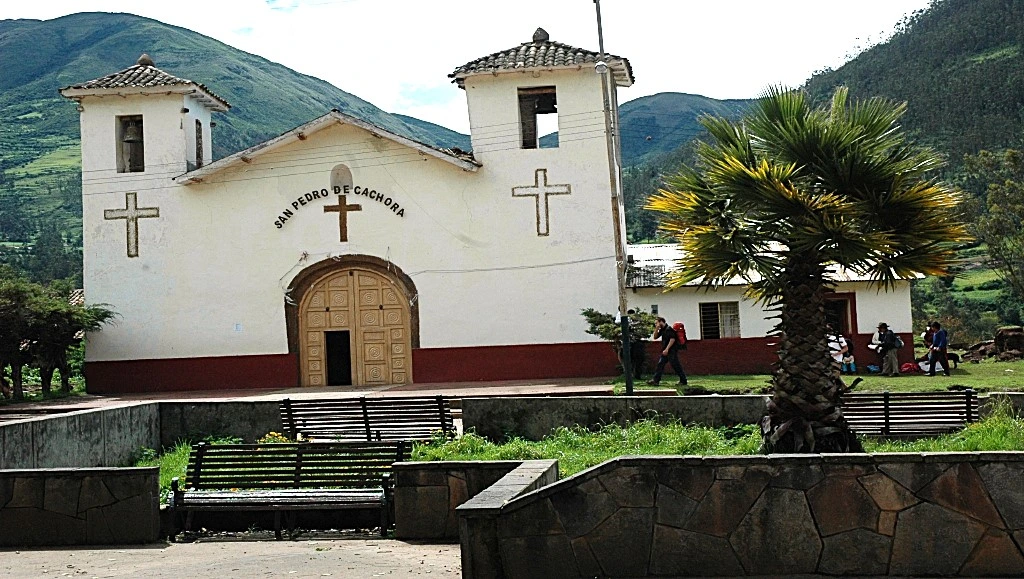
Let’s not get ahead of ourselves. I’ll go back to the beginning. The early wake-up to travel to the 2902 m a.s.l. of Cachora. Cusco is my starting point, and the road to Abancay, the paved route that took me closer to Cachora. If you want to reach this destination by public transport, you’ll need to get off at the Cachora turn-off (let the driver know) and from there take a colectivo. The 160 km journey takes almost 4 hours.
That’s one option. There’s another. If you’re in Lima, head overland to Abancay (17 hours), and after sightseeing in the capital of the Apurímac region (we recommend visiting the Ampay National Sanctuary), continue by colectivo to Cachora (1 hour 30 minutes), where you’ll find accommodations and restaurants. It’s a good idea to spend the night in the village to start the hike at dawn.
El inicio del camino
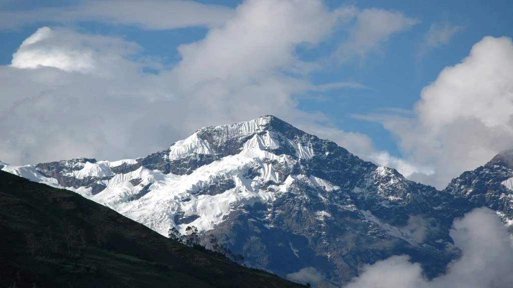
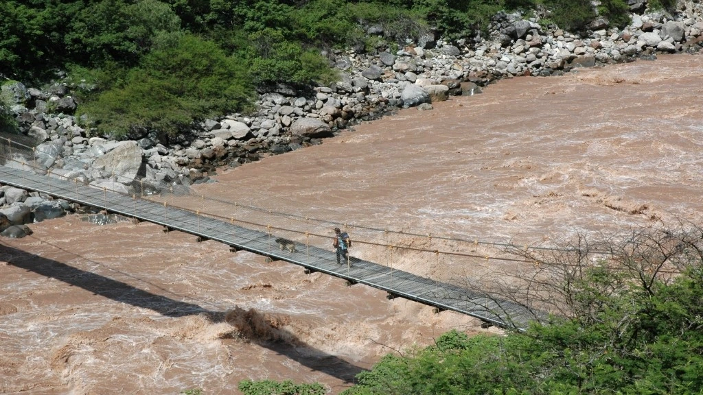
Four days to go and return along a wide trail that isn’t part of the Qhapaq Ñan, the Great Inca Road. That doesn’t take away from the appeal of the trek. There’s no way that can happen when you catch sight of the silhouette of the apu Salkantay or admire the mountains and the powerful flow of the river from the hanging bridge that crosses the Apurímac, the prince of the sonorous, as I once read in a book.
On that bridge, which I crossed both going and returning, and which marks the boundary between the Apurímac and Cusco regions, I felt small, even insignificant, in the face of nature’s grandeur. The same feeling came over me upon arriving—exhausted, sweaty, almost without energy—at Choquequirao, the “Cradle of Gold,” as some call it when translating its name, the “little sister of Machu Picchu,” as others say. “A spectacular place,” I said—without too much poetry—when I saw its stone structures for the first time.
Yes, that first time when every step was a triumph over the distance, the slippery descents, and the winding slopes. So, step by step, on day one, I reached the Capuliyoc pass (elevation: 2915 m a.s.l. Distance: approx. 11 km), where with a bit of luck, one can see the flight of a condor. I wasn’t so lucky. What struck me was realizing just how much I would have to climb to reach my goal.
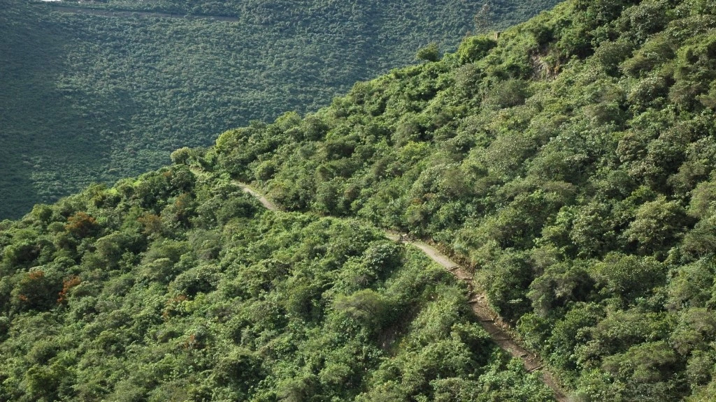
Today, there is a road segment that ends at this natural viewpoint. It’s up to you whether you take a taxi or walk. What comes next is the descent to the river. If you’re traveling solo and without a guide, you’ll need to decide where to camp: at Chikiska (1950 m a.s.l.) or at Playa Rosalina (1550 m a.s.l.), both before the hanging bridge, or extend the first day to Santa Rosa (2115 m a.s.l.), which is already in the Cusco region.
What to do? … On my first time, I camped before crossing the Apurímac. Back then, there were no designated camping areas, and travel agencies didn’t operate the route. Today, things are different. There are tours that depart from Cusco, but unlike the Inca Trail to Machu Picchu, you can head to Choquequirao without being part of a group. Along the trail, you’ll find the essentials for the success of your adventure.
Cada vez más cerca de Choquequirao
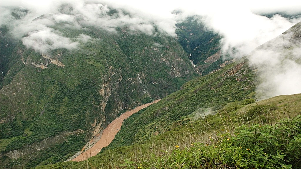
Waking up early to beat the sun so that the Inti doesn’t strike too hard on the ascent. Up, always up, only upwards after crossing the bridge. Again, the nerves, the lack of confidence, the doubts. Will I make it? I move forward without hurry. I count my steps. Twenty in a row, then I rest for a few seconds. This is how I climb the slope that leads me to Santa Rosa (2 hours) and then to the 2800 m a.s.l. of Marampata (2 hours 30 minutes).
I’m tired, but happy because the canyoned geography, the green mountains, the snow-capped apus, the occasional fellow travelers, and the excitement of discovering an Inca city little explored, all fill me with strength and energy. And though I know I still have two intense days ahead of me, in the silence of my tent, I imagine the smile of exhausted satisfaction that will come with taking that last step.
The third day is pure anxiety. Choquequirao (Santa Teresa district, La Convención, Cusco) is close: “two or three more hours,” predict the muleteers hired in Cachora or Capuliyoc. I return to the path. Today the trail is kinder, less challenging. I walk it with confidence. I feel unstoppable. I just want to be in the “Cradle of Gold” for the first time, though little did I know that it wouldn’t be the last time, nor could I have imagined it back then.
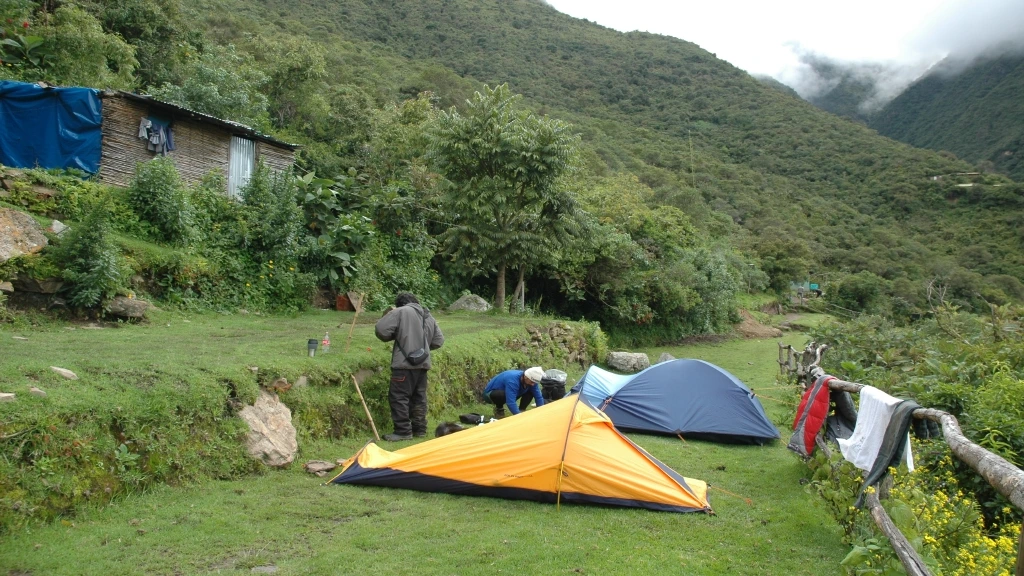
I returned, several years later I returned, and this time I didn’t sleep in Marampata; I stayed at the campsite set up by the Ministry of Culture, just 20 minutes from the archaeological park. That wasn’t the only change. A visiting schedule had also been established (from Monday to Sunday, 7:00 a.m. to 5:00 p.m.), and entry was no longer free. Everyone who arrives pays 60 soles at the control point.
Things change, everything changes, as a song goes. If you decide to come, you’ll find camping areas and even accommodations, along with small shops and restaurants. Today, even the archaeological site is different, because back on that first visit I long for, the terraced fields of the sun’s llamas—one of the most impressive areas—were hidden behind a tangle of vegetation.
Al fin en la “Cuna de Oro”
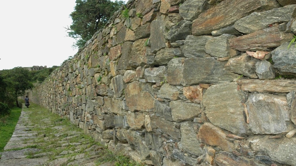
It’s almost there, very close. Choquequirao (3050 m a.s.l.) presents itself with a long stone wall. Just a hint, a fabulous preview of what will be revealed before my eyes when I enter the stone city visited by Hiram Bingham in 1909, two years before his “discovery” of Machu Picchu, or when I climb the ceremonial ushnu to observe the awe-inspiring Andean and Amazonian panorama.
I did it. It wasn’t impossible. I was in the city that is believed to have been built around 1450, “during the height of Inca power,” according to archaeologist Pieter Van Dalen of the National University of San Marcos in Lima. In an article published by BBC Mundo, the scholar of the “children of the Sun” noted that “Choquequirao could have had a population of around 2,000 people.”
But I found an empty and silent city. In that solitude, I wondered what the “Cradle of Gold” truly was. A temple, an administrative center, an agricultural area as evidenced by its terraces, or an important connection point between the Andes and the Amazon. All or nothing. At that time, I didn’t know that it was possible to extend the hike all the way to Machu Picchu. That remains an unfinished journey (a total of 8 days).
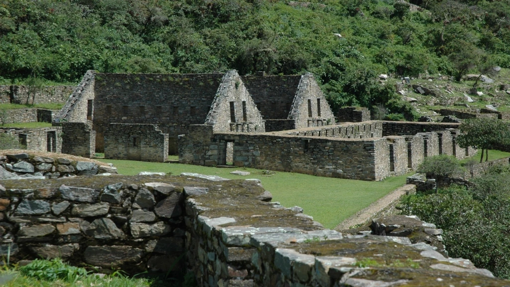
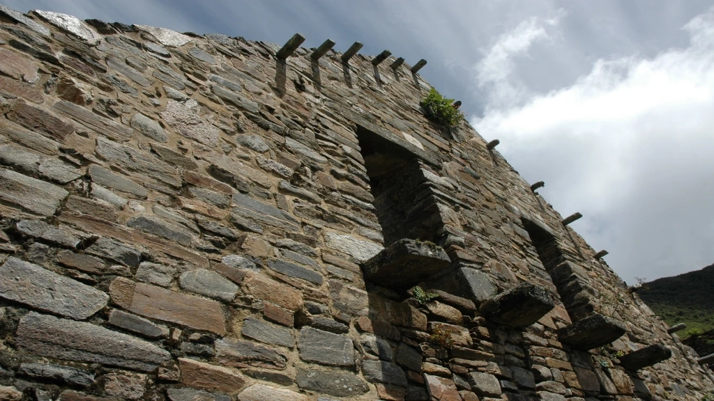
I’m in no hurry. I’m guided by calm and fascination. I head to the main plaza, surrounded by two-story stone buildings, to the priest’s residences, to the rooms known as kallancas, which could have served various functions, to the qolcas where food was stored. I also visit the cemetery or triumphal wall where 17 funeral bundles were found.
The 30 kilometers back to Cachora no longer matter to me. Now, Choquequirao is my refuge, just as it is said to have been for Manco Inca, the ruler imposed by the conquerors, but weary of their abuses, he rose up in arms and besieged Cusco in 1536. Betrayed by one of his own, he retreated into the jungle, where the Neoinca state would form, lasting until 1572.
Third time’s the charm?
Manco Inca was never defeated. Until the last day of his life, he adhered to the customs and traditions passed down by his ancestors. Was Choquequirao truly his last refuge? There are doubts. The aforementioned article mentions that “its difficult access has also fueled the theory that Choquequirao could have been one of the last strongholds of Inca resistance.”
Truth or fiction? I don’t know. What’s certain is that when I was there, the first and second time, I preferred to believe. Traveling is also about surrendering to the paths of legends and myths. Perhaps I wanted to feel a little rebellious and like a warrior on the changing trails that are endless descents, followed by climbs that seem impossible.
They’re not. They never are when you’re convinced that the destination is extraordinary, and you understand that you can always take one more step. And if that’s not entirely true—perhaps, maybe, why not—it’s no sin to travel a few kilometers on the back of a horse rented from an indefatigable muleteer. This is possible on this route because the trail is not part of the Qhapaq Ñan or the secondary Inca roads.
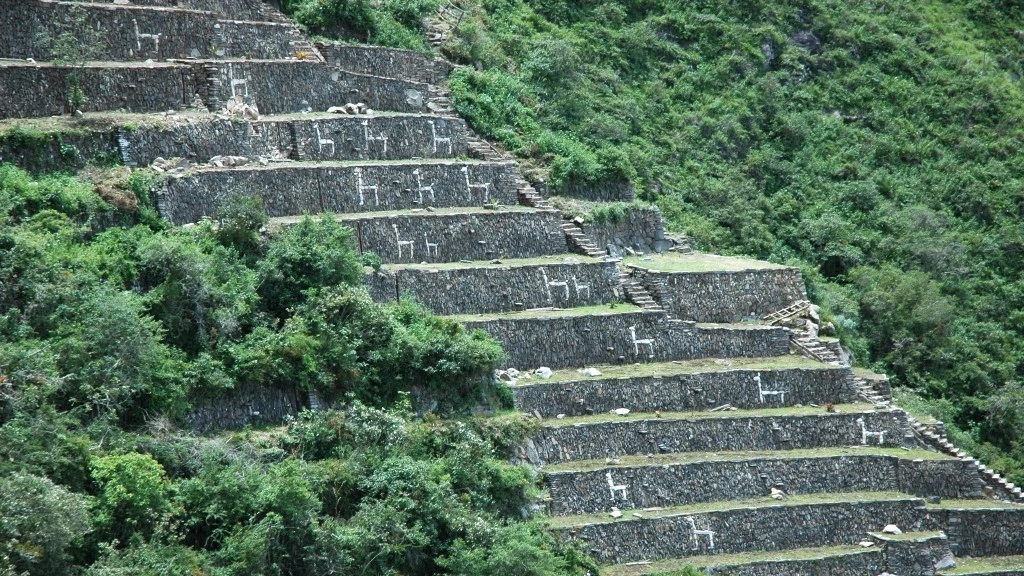
Did I do it on my first visit? I won’t tell you, just as I won’t share what I felt when I discovered the Sun’s llamas on my second visit. That’s another story, but I will tell you, as a preview, that it was worth returning to see the only terraces that feature the image of these noble camelids, outlined with white stones and facing the Apurímac River and the snow-capped Salkantay.
I don’t know if I’ll return. I hope I do. I would love to leave from Cachora and take my final step in Machu Picchu. Perhaps I’ll do it soon, and maybe I’ll meet you on the trail. You, experiencing your first time, and me, encouraging myself with the thought that third time’s the charm. Let it be so, because roads exist to be traveled from start to finish, even if you have to count your steps twenty by twenty.
November 23, 2024